Before we dive into the differences between the 5 GNSS constellations... It's important that we're all on the same page with the difference between GNSS and GPS.
Many people get GNSS and GPS technology confused. A good way to think about the Global Navigation Satellite Systems (GNSS) is as the backbone (or underlying technology) behind GPS. The Global Positioning System (GPS) GPS is a GNSS constellation, but GNSS is not always GPS. GPS is one of the 5 GNSS constellations used around the world.
The 5 GNSS constellations include GPS (US), QZSS (Japan), BEIDOU (China), GALILEO (EU), and GLONASS (Russia). We'll cover each of these constellations in-depth in this post.
The main reason for all 5 satellite constellations is availability and redundancy. If one system fails, another GNSS constellation can help take over. System failures don't happen often, but it's comforting to know there are backup options.
So what's the difference between these 5 constellations? Let's take a closer look at each one...
The 5 GNSS Constellations Explained
1. GPS
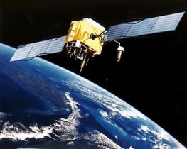
GPS is the pioneer in the world of GNSS. It's the oldest GNSS system that began operation in 1978 and was made available for global use in 1994.
GPS was invented from the need for an independent military navigation system. The United States Department of Defense (DoD) was the first to realize this. A lot of complexity was used in the system to provide high accuracy and also to make it secure against jamming and spoofing attempts. GPS was then made public later down the road.
GPS operates in a frequency band referred to as the L-Band, a portion of the radio spectrum between 1 and 2 GHz. L-Band was chosen for several reasons, including:
- Ionospheric delay is more significant at lower frequencies
- Simplification of antenna design
- Minimize the effect that weather has on GPS signal propagation
Today, GPS is the most accurate navigation system in the world. The latest generation of GPS satellites use rubidium clocks that are accurate up to ±5 parts in 1011. These clocks are synchronized by even more accurate ground-based cesium clocks.
2. QZSS
The Quasi-Zenith Satellite System (QZSS) is the regional satellite system from Japan and is sometimes referred to as the "Japanese GPS".
QZSS currently uses one geostationary satellite orbit and three in the QZO orbit (highly inclined, slightly elliptical, geosynchronous orbit).
The first generation QZSS timekeeping system (TKS) will be based on the Rubidium clock. However, the first QZSS satellites will carry a basic prototype of an experimental crystal clock synchronization system. TKS technology is a novel satellite timekeeping system which does not require on-board atomic clocks and is used by existing navigation satellite systems such as the GPS, GLONASS, and Galileo systems. This allows the system to operate optimally when satellites are in direct contact with the ground station, making it a great solution for the QZSS constellation.
A great benefit of QZSS is this it's compatible with GPS. This ensures a sufficient number of satellites for stable, high-precision positioning.
3. BEIDOU
BEIDOU is a Chinese satellite navigation system that consists of two separate satellite constellations, BeiDou-1 and BeiDou-2 (and soon-to-be BeiDou-3)...
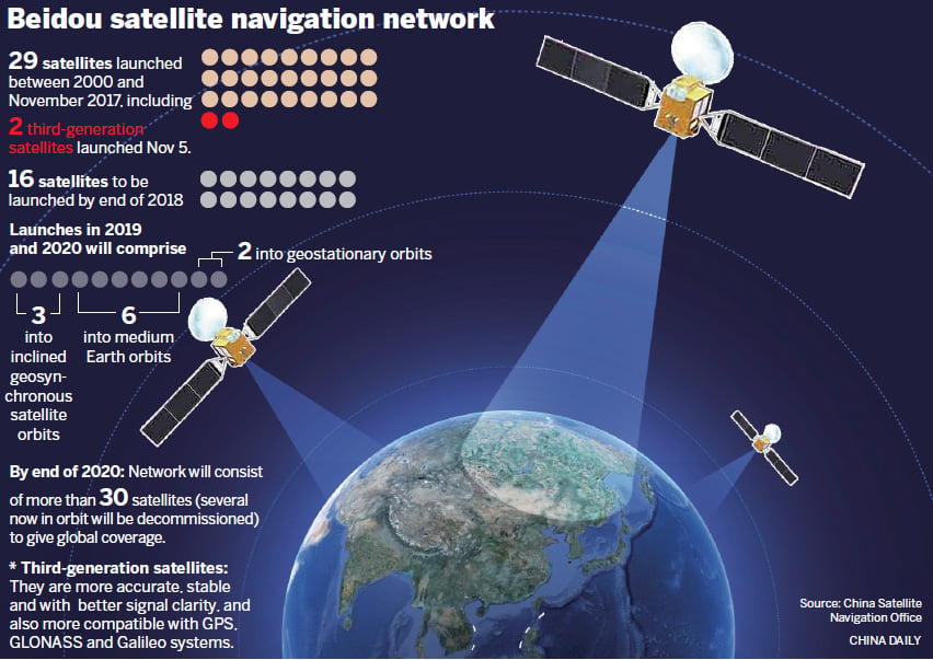
Source: China Daily
BeiDou-1
BeiDou-1 (AKA the BeiDou Satellite Navigation Experimental System) consists of three satellites that offered limited navigation services and coverage. It was mainly used by users in China and neighboring regions. BeiDou-1 was decommissioned at the end of 2012.
BeiDou-2
BeiDou-2 (sometimes called COMPASS) is the second generation of the system. It started operating in December 2011 with a partial constellation of 10 satellites. It has been providing services to customers in the Asia-Pacific region since the end of 2012.
BeiDou-3
China started to build their 3rd generation of the system, BeiDou-3, in 2015. This time... for global coverage.
As of October 2018, there are 15 satellites in orbit. The goal is to have 35 satellites in orbit by 2020 which will provide the global services when completed.
Once fully launched and operational, BeiDou-3 will provide an alternative to U.S GPS, GLONASS, or GALILEO. BeiDou-3 is expected to be even more accurate with millimeter-level accuracy (with post-processing).
Fun fact: According to China Daily, in 2015 (fifteen years after the BeiDou-1 system was launched) it was generating a turnover of $31.5 billion per year for major companies such as China Aerospace Science and Industry Corp, AutoNavi Holdings Ltd, and China North Industries Group Corp.
4. GALILEO
GALILEO is Europe's GNSS system that's compatible with GPS and GLONASS. It started providing service in December 2016.
GALILEO's receivers track the satellite constellation's position in what's called the "GALILEO Reference System" using satellite technology and triangulation principles.
The Galileo system is divided into three main segments...
- Space
- Ground
- User
The space segment's function is to generate and transmit code and carrier phase signals with a specific Galileo signal structure. It also stores and retransmits the navigation data sent by the Ground Segment.
The ground segment is the major system element that controls the entire constellation including navigation system facilities and dissemination services. The ground segment is made up of:
- Two Ground Control Centers (GCC)
- A network of Telemetry
- Tracking and Control (TT&C) stations
- Network of Mission Uplink Stations (ULS)
- Network of Galileo Sensor Stations (GSS)
The user segment is made up of GALILEO receivers. The main purpose here is to track the satellite constellation's coordinates and provide very accurate timing. This is done by of course receiving the Galileo signals, determining pseudo ranges (and other observables), and solving the navigation equations.
GALILEO is expected to reach its Full Operating Capability (FOC) by 2020.
5. GLONASS
Finally, GLONASS is Russia's version of GPS. Development began in 1976 by the Soviet Union. There are 5 versions of GLONASS including:
- GLONASS (1982)
- GLONASS-M (2003)
- GLONASS-K (2011)
- GLONASS-K2 (2015)
- GLONASS-KM (2025 - Currently in research phase)
Assisted GLONASS
Assisted GLONASS (A-GLONASS) is pretty much the same as GLONASS but has more features for smartphones. These features include turn by turn navigation, real-time traffic data, and more. A-GLONASS uses near by cell towers to lock your precise location quickly. It also improves the performance of in chip-sets that come with GLONASS support.
The Difference Between GLONASS and GPS GNSS
For starters, the US GPS network includes 31 satellites, while GLONASS uses 24 satellites. The 2 systems also differ somewhat on accuracy. GLONASS position accuracy is 5-10m while GPS is 3.5-7.8m. Therefore, GPS outweighs GLONASS in accuracy as lower error numbers are better.
As far as frequencies go, GLONASS operates at 1.602 GHz and GPS at 1.57542 GHz (L1 signal).
When used alone, GLONASS doesn't provide as strong of coverage compared to GPS. In fact There are no significant advantages of GLONASS over GPS.
GLONASS is a great back-up for GPS. When GPS signals are lost (like when you're between tall buildings) GLONASS has your back.
What Do All GNSS Constellations Have In Common?
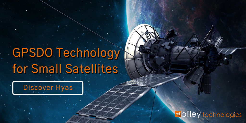
The short answer is the need for accurate timing and accuracy. This is typically achieved by high-performance rubidium atomic clocks or LEO Satellite GPSDOs. Here at Bliley Technologies, we've applied over 85 years of frequency control experience to bring the world some of the best timing solutions for GNSS constellations and LEO satellites.
You should definitely consider downloading the full datasheet for Hyas, our new GPS Disciplined Oscillator (GPSDO) specifically designed for LEO Satellites and GNSS constellations. I think you'll like what you see!